Skip to content

See everything you can build.

A map-first workspace for property. Enter an address and the buildable envelope appears in 3D on the real lot. Residential and commercial, graded by how good the evidence is.

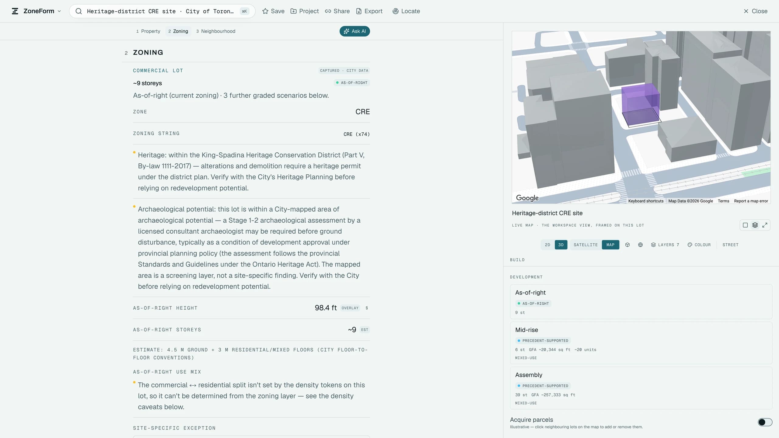
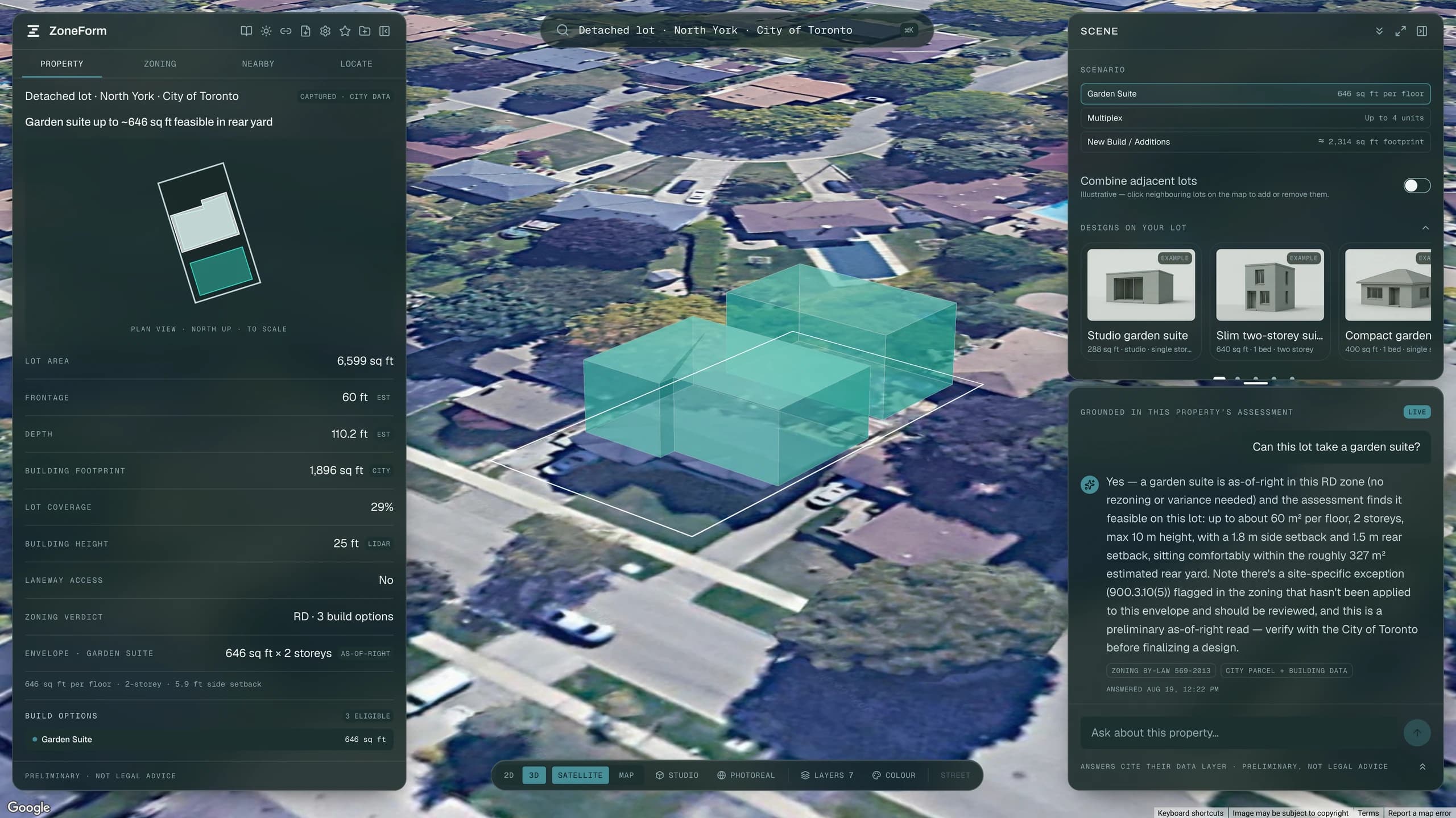
The ZoneForm workspace on a Toronto lot: a buildable envelope drawn in 3D over satellite imagery, with the property panel open beside it.
How it works

How an address becomes an answer.

Feasibility should take minutes. Every layer is published somewhere else, by someone else. Reconciling them on the real parcel ring is the work.

ResidentialA low-rise lotCommercialWith its neighboursZoningHeightParcelHeritageRavinePrecedents42 Maplecote DrSAMPLERD · By-law 569-2013Garden suite646 sq ft · 2 storeysMultiplex2,971 sq ft · 4 unitsNew build2,314 sq ftSCREENED6 layers screened on this lot215 Fenmark St WSAMPLECR · By-law 569-2013As-of-right9 storeysMid-riseGFA ~20,344 sq ftAssembly39 st · ~257,333 sq ftSCREENED6 layers screened on this lot
A garden suite and a thirty-nine-storey assembly are the same question asked of the same engine, read on the real parcel outline and graded, the residential path on its own three-state confidence scale, the commercial one on the four-state evidence ladder.
What it does

An answer, what could stop it, and the document you send.

One workspace. Pick a lot, get an answer, see what could stop it, send the document.

01 · On a house lot

Every residential path

Garden suite, laneway, multiplex or new build, tested against the by-law on the real parcel outline.

Garden suites

The rear-yard envelope from the real parcel geometry: separation, setbacks, angular plane, storey and height caps, drawn to scale.

Laneway access

Reads whether a public lane abuts the lot from the City's centreline data, and applies it. A lane lifts the suite from one storey to two.

Multiplex

Envelope and unit count for a conversion or a rebuild, with the coverage and height controls that actually bind it.

New build & additions

The whole-lot envelope: coverage, height, storeys and setbacks, plus the front building line derived from the neighbours on the street.

Adjacent lots

Combines a lot with its neighbour and recomputes against the merged outline, with a comparison against keeping them separate.
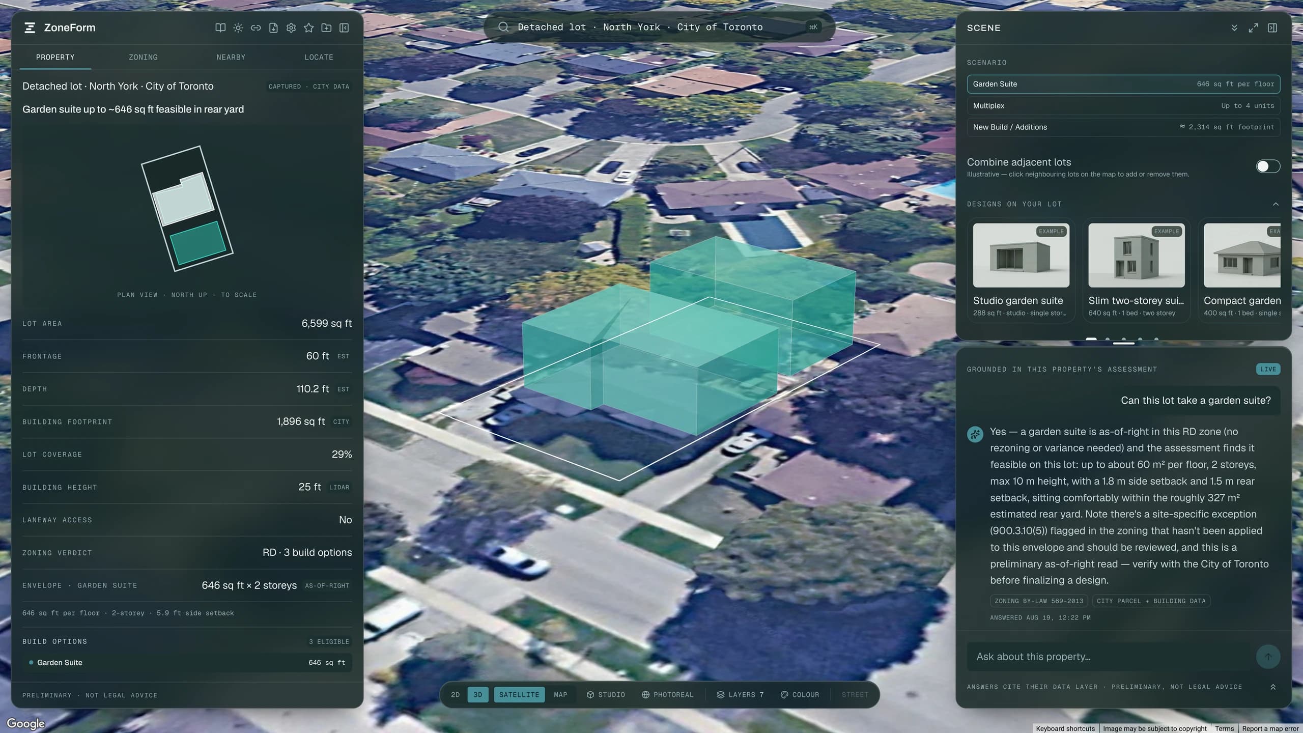
A Toronto residential lot in ZoneForm with garden suite, laneway and multiplex options listed, each carrying an evidence grade.
02 · On a commercial parcel

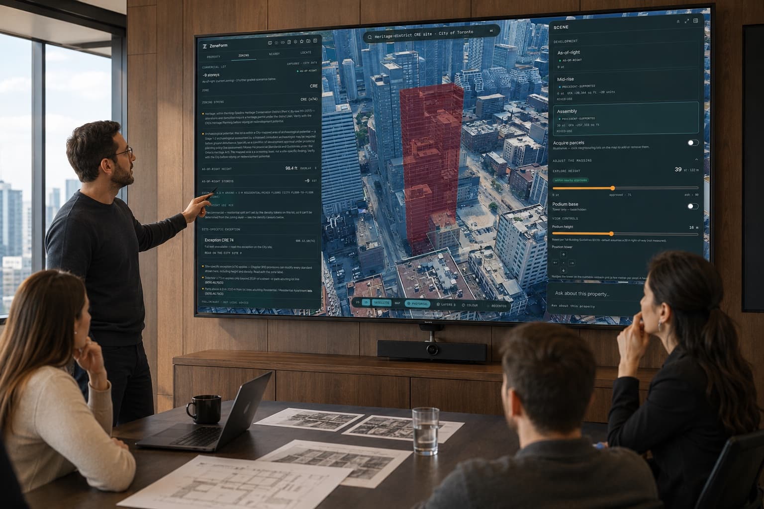
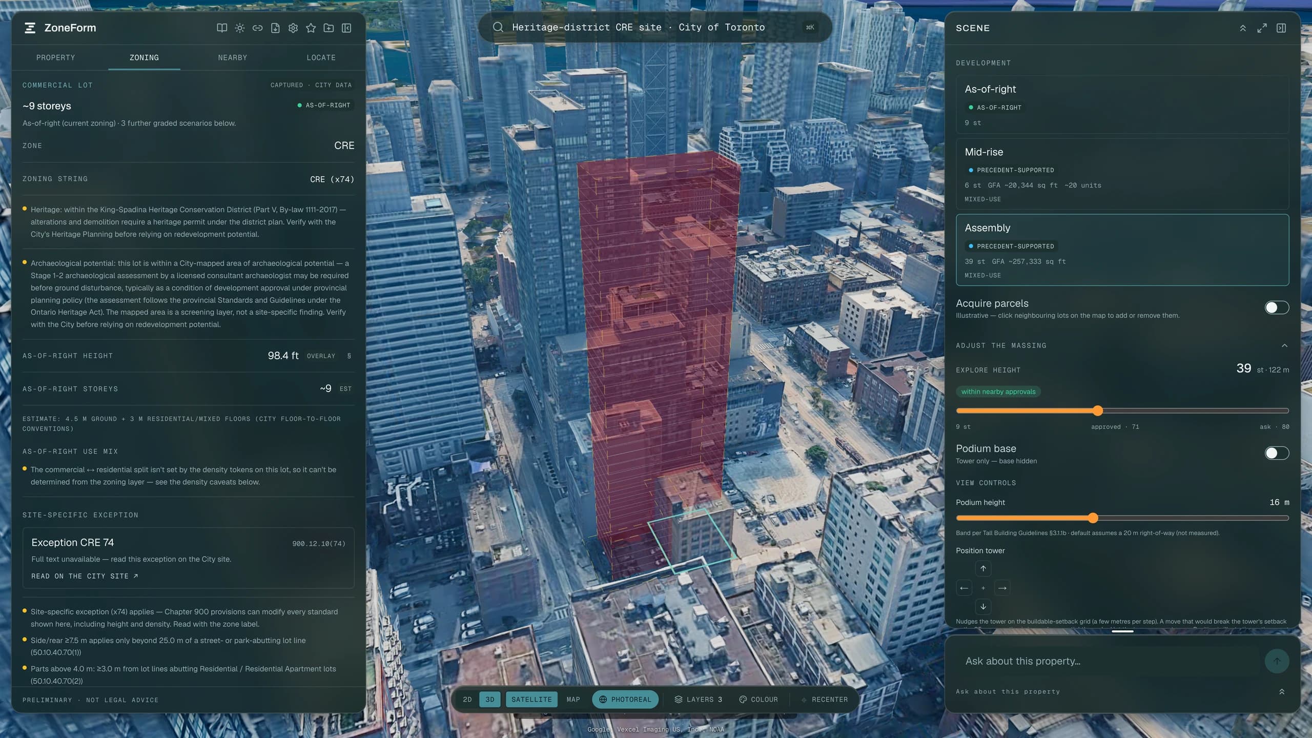
As-of-right to assembly

The same engine on the commercial ladder, from as-of-right up to an assembly of neighbouring lots.

As-of-right

Density, height and setbacks straight from By-law 569-2013 with clause citations, and the use split between commercial and residential GFA.

Mid-rise

A mid-rise scenario graded against comparable approvals nearby, with the sample size shown.

Tall buildings

Podium footprint from per-edge erosion against the zone's own standards, including CRE's 25 m street band. The tower plate is tested for fit.

Land assembly

Compose a site by clicking parcels on the map. Hand-picked assemblies pass the same four gates as suggested ones: area, fill, contiguity, fit.

Maximum use

Packs towers into the parcel or the assembled union at compliant plates, laddering plate size to find the greatest total area.

A downtown Toronto parcel in ZoneForm with neighbouring lots assembled and a scenario ladder open beside the massing.
03 · Before you commit

What governs the lot

Six layers read against the real parcel ring rather than a point at its centre.

3D massing

One scene builder, one envelope, and every way the product draws it: Plan view, 3D over satellite, Photoreal, Studio.

Constraints & exceptions

Heritage, ravine, rental replacement, archaeology and secondary plans, each read against the real parcel outline rather than a point at its centre.

Shadow & solar

Casts the graded massing against City green space at the statutory dates and hours, and reads roof planes and panel capacity the other way.

Neighbourhood

Committee of Adjustment outcomes with sample sizes, live applications, census, transit and street trees within a stated radius.

Site sweep

Reads every parcel across an area against its own zoning and ranks them by the gap between what stands there and what the by-law allows.

ZoneForm showing a constraint layer flagged on a Toronto parcel, with the source of the flag named in the sidebar.
04 · When you are ready

Ask it about the lot

Answers cite the layer each claim came from, and the same assessment leaves as a document.

Development report

Graded scenarios, a site plan on every scenario page and a 3D capture on the headline envelope, with your logo and typeface on the cover.

Site context report

A due-diligence brief that leads with what could stop the project, then policy, then the neighbourhood, closing on a Sources page.

Spreadsheet export

A one-sheet XLSX serialising the identical model the PDF renders, so the numbers cannot disagree.

AI assistant

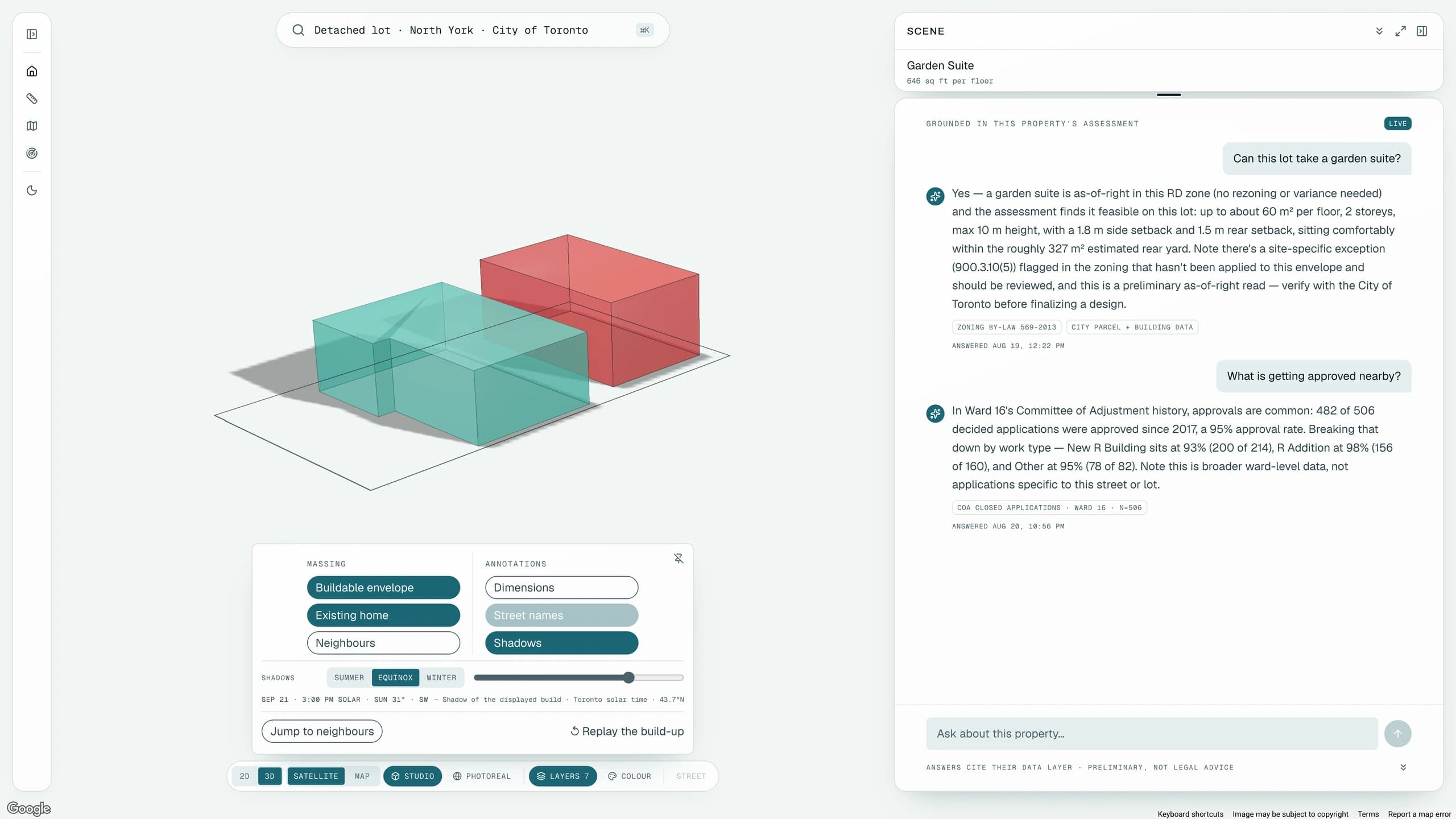
Ask about the loaded lot and get an answer citing which layer each claim came from, with the preliminary disclaimer where it applies.

Share & saved lots

Keeps the lots you have opened, and sends a colleague the same live view by link. The link reconstructs the assessment, with nothing stored.

ZoneForm's assistant answering a question about a loaded lot, with the source layer cited beside the claim.
Industries and roles

Find the one on your business card.

Everyone here has to answer “what can we build here?” for a living, and every one of them arrives at it from a different direction.

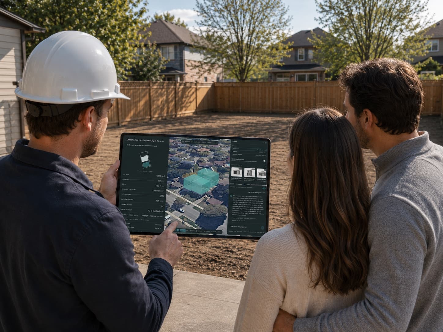
  • A design-build professional showing a homeowner a garden suite envelope on their own lot, on a phone, standing on the driveway.

    Answer on the driveway, not next week. A rear-yard envelope drawn to scale on the owner's own lot, with every eligible path graded and sized. They see their property rather than a plan somebody has to teach them to read.

    Design-build firms · Renovators & additions · Agents advising owners

    What residential feasibility gets
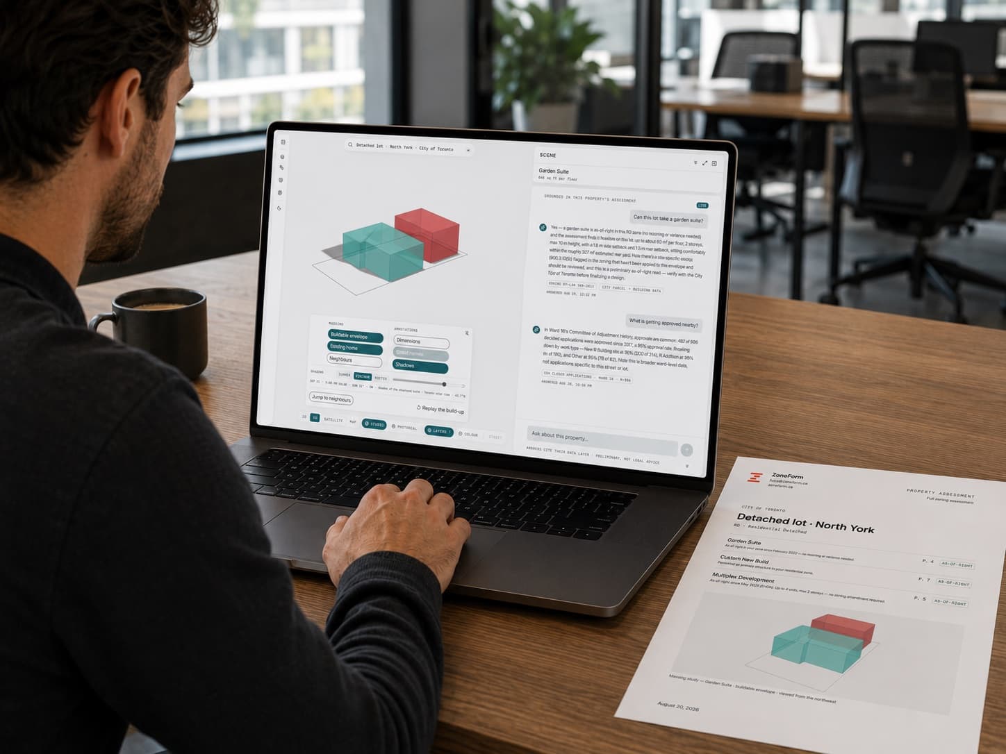
  • A developer reviewing a ZoneForm scenario ladder on a laptop, with a printed site plan on the desk beside it.

    Screen a street before you commit to one site. As-of-right through maximum use, each scenario carrying its GFA, storeys and the evidence tier behind it. Rental replacement and the conservation limit arrive in the first read rather than in due diligence.

    Developers · Land buyers · Brokers

    What development potential gets
  • A planner reading a ZoneForm site context report on screen, with the parcel outline shown on a second monitor.

    The first pass, finished before you quote the fee. Constraint-first, with the governing clause reproduced as written and a Sources page naming every layer the report drew on. The hours you bill become the judgement rather than the gathering.

    Architects · Planners & consultants · Lenders

    What professional due diligence gets

Every ZoneForm output is preliminary and not legal advice. It is a first-pass reading of the City’s own data, meant to be verified with the City before anyone spends money on it.

Bring a lot you already know. See whether it agrees with you.

The fastest way to judge this is to run an address whose answer you can check.

Book a demo